 F4LUFTBILDER
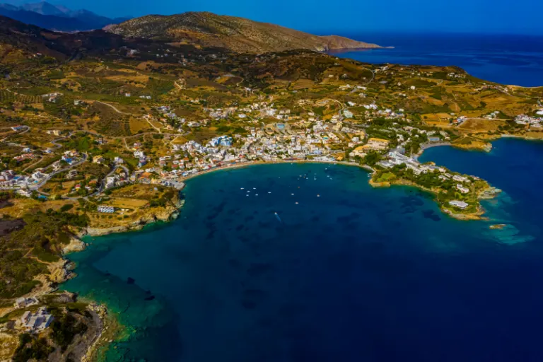


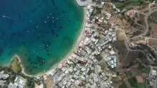
Agia Pelagia and the curved beach line
At Agia Pelagia the houses follow the bay that extends deep into the land. The beach describes a bright line between town and water. From above you can clearly see where this line is interrupted by rocks and how far up the slope the development continues.
The shape of the bay of Agia Pelagia
In Agia Pelagia, the beach and rows of houses follow the same arc. A wide view allows both lines to be compared, while the closer view primarily shows the course of the bank development.
The two sides of a bay do not have to take up the same amount of space in an aerial photo. Often the closer headland obscures part of the opposite bank. A higher view opens up the space in between and shows the transition to open water. This makes a second view particularly valuable for depicting the location. While one image explains the location on the coast, the other can show the sheltered interior area, where the course of the shore and the use of the land are more clearly visible.
The narrow zone between land and water
From a low angle, a beach often looks like a narrow, light fringe. The bird's eye view reveals its actual shape and shows where it widens or ends at a protrusion. In addition, connections to the hinterland emerge. The section where a path or buildings reach the beach can be particularly interesting for a townscape. There the location can be specifically named and the individual motif can be found within a longer stretch of coast.
What the roofs reveal about the floor plan
A city center can often be read by its roofs. Where narrow gables are close together, the street space is also divided into short sections. A large, connected building interrupts this sequence. In the aerial photo you can follow the direction of an alley from such an interruption. For an illustration in a smaller format, a section with just a few easily distinguishable roof groups is worthwhile. In a large print, however, the spaces and small changes in direction are allowed to keep their place.
The distribution of blue tones
To switch between two of the 6 aerial photos, shot 5 and shot 2 can be called up directly in the gallery. In the first excerpt, shades of blue play a smaller role. In the second shot, blue areas take up more space. Blue can extend over a large contiguous area or only appear in individual parts. What also counts for the effect is whether these areas extend to the edge of the picture or surround the main subject.
Shot 1 and Shot 6 are among the views from October 7, 2020. According to the camera's time information, there are approximately 2 minutes between the two images. The exposure time was 1/640 second for the first of the images mentioned and 1/500 second for the second.
A moving view is also available. The clip “Agia-Pelagia on Crete from the air” can be found under Aerial videos. The linked preview leads to inclusion in the aerial photographer's portfolio on Adobe Stock.
Select the coastal view for a photo series
In a coastal view, water is both a motif and an open space. Whether a large piece of sea remains in the picture depends on the story. When reporting on the shoreline, it holds different landforms together. For a portrait of a coastal town, the development may need more space. An aerial photographer can take this difference into account when choosing the angle of the image. When publishing, it's worth taking a final look at the final format so that a headland or riverside path at the edge isn't accidentally cut off.
Related motifs in the aerial photo archive
Two additional views can be used in the archive for comparison. The first can be found under Ligaria – Crete. In the aerial photos, the bay of Ligaria is framed by an almost closed semicircle of buildings and rising terrain. The second belongs to the article Potamos Beach – Crete. At Potamos Beach in Crete, light sand creates a curved edge around the shallow water.
Aerial photos of Agia Pelagia – Crete
Your aerial photographer across Europe
Request a free quote