 F4LUFTBILDER
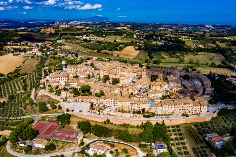


Montecosaro on the ridge
Montecosaro stands out as a long settlement in front of the green surroundings of the Marche. The town center sits significantly higher than the fields in the foreground. In the side aerial view, the edge between connected buildings and sloping terrain can be followed particularly well.
An Italian town on the ridge
In Montecosaro the development extends over a ridge. The field areas on its flanks show where the closed townscape ends and merges into the open surroundings.
The silhouette of a mountain range is a good way to start looking. First you notice the highest point, then the succession of saddles and flatter sections. In an oblique shot, this profile connects with the shapes in the foreground. A steeper perspective takes more interest in the surface of the slope. A direct comparison makes it understandable why a location can change significantly when the viewing angle changes, even though the recognizable heights in the background remain the same.
What the roofs reveal about the floor plan
If you look at it at an angle, the houses not only show their roofs, but also their facades of different widths. This gives the motif more depth than in the pure top view. Even the change from a low neighboring building to a taller building reveals something about the gradation of the place. Such a view is particularly useful for a local chronicle if the caption indicates the starting point of the view. Readers can then follow the rows of houses themselves to the edge of the picture.
Field boundaries as a benchmark
On a map, fields become similar areas. In the aerial photo they differ in color, structure and processing direction. A bright dirt path divides two plots, a row of trees interrupts the straight lines. In such places, the size of the open hallway is better understood than by just looking at the horizon. Color changes should initially be left as an observation. Which crop is growing in a field or when it was cultivated can often only be determined from a single photo with additional local knowledge.
The distribution of blue tones
To switch between two of the 5 aerial photos, Shot 1 and Shot 5 can be called up directly in the gallery. In the first excerpt, shades of blue play a smaller role. In the second shot, blue areas take up more space. Blue can extend over a large contiguous area or only appear in individual parts. What also counts for the effect is whether these areas extend to the edge of the picture or surround the main subject.
Shot 1 and Shot 5 are among the views from September 30, 2020. According to the camera's time information, there is less than a minute between the two images. ISO 100 and an exposure time of 1/500 second are recorded for both files.
In the Aerial Videos section there are 2 clips for this article. An example is “Montecosaro - The city of Montecosaro in Italy from the air”. Its preview leads directly to the video in the aerial photographer's Adobe Stock portfolio.
Select landforms for a landscape portrait
A single contour line can shape the impression of a landscape and yet reveal little about its extent. For a printed panorama, it is worth looking at the widest view first and then at a section of the same area. In a small format, a foreground with a clear contour can become more important than the most distant peak. If you plan a new view with an aerial photographer, you can make this decision based on the intended page layout and clarify in advance which part of the landscape definitely belongs in the picture.
Related motifs in the aerial photo archive
Two additional views can be used in the archive for comparison. The first can be found under Apulia. In the series from Puglia, bright, densely built-up places stand next to rocky stretches of coast. The second belongs to the article Italy – San Gimignano. Above San Gimignano, the tall stone towers stand close to much lower roofs.