 F4LUFTBILDER
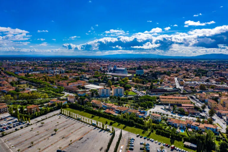


Pisa's urban structure beyond the individual landmark
The aerial photos of Pisa provide a view of a largely flat urban landscape. Straight streets and blocks of buildings of different sizes can be traced across several districts. The horizon remains low, so that the expansion of the Tuscan city becomes the actual subject of the picture.
The view over the roofs of Pisa
An aerial photo of Pisa can deliberately embed a single sight into the city plan. The paths there and the buildings beyond the well-known motif then tell the story.
The gaps between the houses reveal how tightly built the place is. An inner courtyard opens up the roof structure, a treetop covers part of it, and a wide street separates two blocks. Anyone who looks at the photo can follow these gaps and get a clearer picture than if they tried to identify each building individually. A particularly suitable view for a city portrait is one in which the view from a clearly visible roof can move on to the neighboring streets.
Order along a line
To find your way around an unfamiliar townscape, you can follow a continuous line until there is a noticeable change in direction. It is often only on this path that small junctions or free spaces become apparent. The image section determines how much of this order remains visible. If the beginning of the line remains in the foreground and its destination remains in the back part of the image, a photograph has a clear reading direction even without drawn arrows. It's particularly worth looking at in a portrait format.
The distance in the composition of the image
The position of the horizon determines how much space the landscape receives. If it is high in the image, more details can be seen on the ground. A lower horizon gives greater weight to the sky and weather. Both options can accurately describe a place if the connection to the main motif remains recognizable. When comparing two aerial photos, it is worth taking a look at the foreground. Often it is an inconspicuous piece of land at the bottom edge of the picture that conveys a sense of the vastness.
The distribution of blue tones
If you browse through the 8 aerial photos, you can stay at shot 5 and shot 8 for a comparison. In the first excerpt, shades of blue play a smaller role. In the second shot, blue areas take up more space. Blue can extend over a large contiguous area or only appear in individual parts. What also counts for the effect is whether these areas extend to the edge of the picture or surround the main subject.
For Shot 1 and Shot 8, the same day is noted in the image files, September 29, 2020. The recording times recorded are about 3 minutes apart. ISO 100 and an exposure time of 1/1250 second are recorded for both files.
Prepare a cityscape for readers
For a city history, it can be informative to place the aerial photograph next to a street view. In one picture the roof is the reliable reference point, in the other it is often the entrance or the facade. The transition is best achieved via a corner, a square or a visible junction. An aerial photographer can take this connection into account when taking photos. In the printed photo series, a brief note about which side of the street the next photo was taken from is often enough.
Related motifs in the aerial photo archive
If you are looking for related motifs, you can start with Italy – San Gimignano. Above San Gimignano, the tall stone towers stand close to much lower roofs. It's worth taking a second look at Lucignano. In Lucignano, the roofs wind in strikingly closed rings around the town center.
When you look at Italy – San Gimignano, you can delve deeper into a detail. In San Gimignano the spacing of the towers is as interesting as their heights. Above the roofs, they mark different parts of the city and make it easier to compare two perspectives.