 F4LUFTBILDER
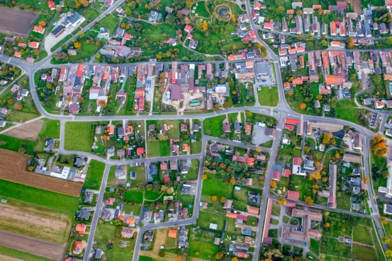


Leśnica in the network of its streets
Leśnica, in German Leschnitz, shows strikingly clear streets in the overview. Gardens and green interior spaces remain legible between the roofs. Towards the edge of town, these gaps increase until there are only a few houses left between the fields.
A townscape with two names
The two names Leschnitz and Leśnica belong to the same place in Poland. It's worth knowing both spellings, especially when searching for images. A motif with the course of several streets is usually more understandable for a local portrait than an unlabeled row of individual houses.
A village view needs a comprehensible starting point. This can be an intersection, a prominent group of houses or the end of a street. From there, the paths to the outskirts of town can be more easily followed in the image. When publishing for readers from outside, a brief location information in the caption helps. Resident viewers are often interested in another level. They are looking for the location of a house, the route of their route to school or a familiar open space between buildings.
Order along a line
To find your way around an unfamiliar townscape, you can follow a continuous line until there is a noticeable change in direction. It is often only on this path that small junctions or free spaces become apparent. The image section determines how much of this order remains visible. If the beginning of the line remains in the foreground and its destination remains in the back part of the image, a photograph has a clear reading direction even without drawn arrows. It's particularly worth looking at in a portrait format.
Field boundaries as a benchmark
From a greater height, the field appears to be an orderly floor plan. A closer look shows how the paths change direction at curves, embankments and property boundaries. When selecting images, it is helpful to preserve at least one of these transition points. It turns a colored area into a piece of actually used landscape. For an article about the surrounding area, even the inconspicuous edge of a field can explain more than a wide section that only shows numerous plots as small spots.
The distribution of blue tones
Among the 6 photos in the gallery, shot 4 and shot 3 provide a good starting point for the comparison. In the first excerpt, shades of blue play a smaller role. In the second shot, blue areas take up more space. Blue can extend over a large contiguous area or only appear in individual parts. What also counts for the effect is whether these areas extend to the edge of the picture or surround the main subject.
The camera captured October 6, 2022 for shot 1 and shot 6. The time interval between these two views is approximately one minute. For shot 1, ISO 400 and an exposure time of 1/30 second are saved.
A townscape for chronicle and community
For a local chronicle, the outer edge of the development is just as interesting as the middle. That's often where things change first. A meadow becomes a building site, a driveway is given a new route, a single house disappears behind the larger trees. If you want to talk about the same place again later, a dated overall view is helpful. You can agree with the aerial photographer on a point that should remain in the image when repeated. A street intersection is usually better suited for this than a moving object on the side of the road.
More aerial photos for comparison
Two further articles invite comparison. In the first, Czech Republic – Otrocice, another detail is in the foreground. In Otročice, the first thing you notice is the difference in size between the small houses and the surrounding fields. After that, Beienheim is a good option. In the views of Beienheim, the houses form a closed figure between fields of contrasting colors.