 F4LUFTBILDER
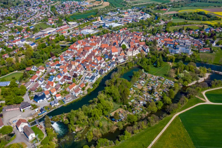


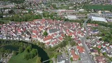
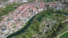
Munderkingen in the Danube loop
The Danube forms a pronounced curve around the buildings near Munderkingen. On one side the roofs move together, on the other more open green spaces appear. Even a wide section above the river arch explains a large part of the city's layout.
Where the Danube draws the city plan
In Munderkingen, the Danube loop explains the shape of the city center. The meadows on the river banks prevent the flow of water between the houses from disappearing from the picture.
At the river it is worth taking a second look at both edges of the picture. Sometimes a road ends there and continues along the water in the next section. In another place, a line of trees frames a stretch of bank. Such clues connect the place with its river valley. For a double page spread, you can choose an overview showing the course and juxtapose it with a close-up view of the shore. It helps if at least one bend in the bank or a building can be found in both motifs.
What the roofs reveal about the floor plan
If you look at it at an angle, the houses not only show their roofs, but also their facades of different widths. This gives the motif more depth than in the pure top view. Even the change from a low neighboring building to a taller building reveals something about the gradation of the place. Such a view is particularly useful for a local chronicle if the caption indicates the starting point of the view. Readers can then follow the rows of houses themselves to the edge of the picture.
Preserve open land in the picture
A meadow may look almost empty in a small preview. The larger view shows paths, individual shadows or transitions to neighboring properties. As a foreground, it creates distance before the view reaches the houses or the next slope. This distance is often an important part of the composition in landscape photos. If it is pruned too much, the development will appear denser. A deliberately wider section, on the other hand, shows what space the open land actually takes up.
Shades of green in the image
For a direct image comparison, use shot 4 and shot 2 from the gallery with 6 aerial photos. In the first image, green areas make up a smaller part of the section than in the second. It's worth tracking the green areas individually. Only in connection with neighboring forms does it become clear what is in the foreground and what belongs to the more distant surroundings.
According to camera data, Shot 6 and Shot 1 were taken on April 26, 2020. There is a gap of around 2 minutes between the two images. The exposure time was 1/640 second for the first of the images mentioned and 1/320 second for the second.
The Aerial Videos section supplements the photos with 2 clips. The aerial photographer’s photographs linked there include “Munderkingen aerial images”. The relevant video page on Adobe Stock can be opened using the respective preview.
Explain the course of the river in the picture
For a publication about a river, it is worth explicitly naming the bank side if it is known. The left side of the photo and the left bank of the river are two different details. The photo can look in any direction, the bank name follows the direction of flow. Anyone who describes a desired view to the aerial photographer can therefore orientate themselves on a bridge, a settlement or an easily identifiable section of the bank. The same reference points make it easier for the reader to orient themselves later when the river appears to be going in a different direction in the next shot.
Related motifs in the aerial photo archive
The article Riedlingen offers another perspective. In Riedlingen, the red roofs of the old town are close to the water. In the gallery Donaueschingen there is a different focus. Brigach and Breg flow together near Donaueschingen.
Aerial photos Munderkingen
Aerial photography & aerial videos
Your aerial photographer for Munderkingen and the surrounding area
F4 Luftbilder - Your specialist for aerial photography and aerial photography in Munderkingen and the surrounding area. Benefit from our many years of experience and technical equipment and let us convince you of quick implementation and unbureaucratic processing. We look forward to inspiring you with breathtaking aerial photographs and aerial photos in Munderkingen and the surrounding area.
Services
Aerial photos in 4K resolution
Aerial videos in 4K resolution
Individual perspective wishes
Including image editing
All necessary permits and insurance
Free travel to Munderkingen and the surrounding area
Your advantages
Direct contact person
No appointment required
Unbureaucratic & short-term processing
Pay conveniently by invoice: bank transfer & Paypal
Delivery of images conveniently via download
Order processing within 10 days
Request a quoteA photographic journey of discovery: Munderkingen from the air
A photographic journey of discovery: Munderkingen from the air
Munderkingen is a small town in southern Germany and is considered an insider tip by many people. The city is known for its beautiful half-timbered houses, the medieval market square and the idyllic landscape. But Munderkingen has much more to offer! From above you can not only see the most beautiful sides of the city, but also how harmoniously the various buildings are embedded in the landscape. A visit to the city is definitely worth it – especially for photography fans.
Breathtaking views: Munderkingen from lofty heights
Munderkingen is located in the Biberach district in Upper Swabia and is actually a completely normal, small village. But as soon as you look at it from the air, its true beauty is revealed: the buildings seem to line up perfectly, forming a harmonious whole. Added to this is the impressive landscape around Munderkingen - green meadows, shady forests and extensive fields characterize the picture. The view is breathtaking, especially at sunrise or sunset! So if you want to escape the daily grind and discover something new, you should take a look at Munderkingen from above - it's worth it!
Unique perspectives: Munderkingen from above
Viewed from above, a completely new perspective of our hometown of Munderkingen is revealed. In the past few weeks and months I have been photographically searching for special motifs in and around Munderkingen - with some astonishing results! The view of well-known sights such as Munderkingen Castle or the St. Jakobus Church is particularly interesting, but there is also a lot of interesting things to discover off the beaten track. You can find some of my photos in this blog post, I hope you like them and you can now get your own idea of Munderkingen's most beautiful side!