 F4LUFTBILDER
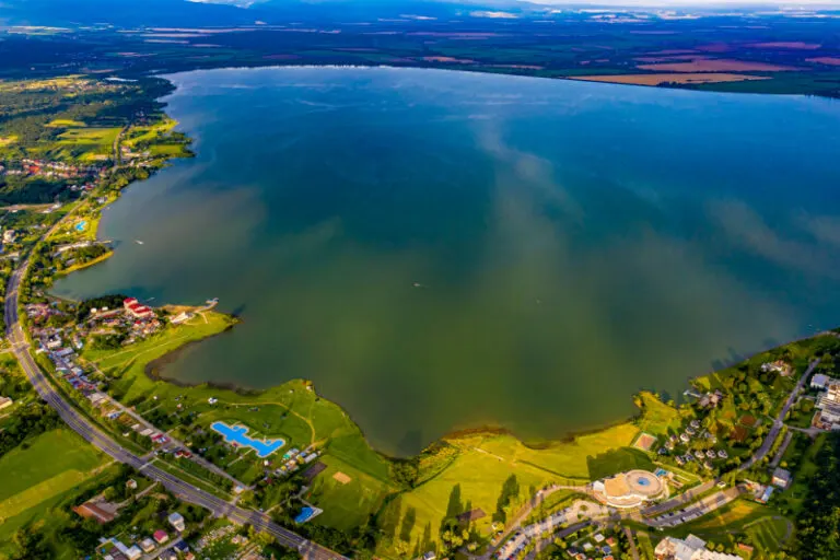


The water surface of the Zemplínska šírava
At the Zemplínska šírava in Slovakia, the lake takes up most of the field of view in the wide shots. Individual bank locations provide the scale. From there you can follow the transitions from the shallower, different colored water to the darker areas further out.
The shore as a reference point
At the Zemplínska šírava, the wide expanse of water can almost completely fill the foreground. A remnant of shore remains important in order to classify the view as a view of an inland body of water.
On a lake, a large area can appear almost uniform. Only an arch on the bank, a boat or the reflection of a slope gives the eye something to hold on to. In aerial photography, the image often appears particularly spatial, as it contains a piece of land in the foreground in addition to the water. For a wide image, the water surface can have more space. In a narrow format, their connection to the shore should be retained so that the landscape becomes a recognizable place and not just any blue area.
The shore zone in detail
On the bank, the familiar solid surface and the changing water surface lie right next to each other. An embankment or a narrow path can appear significantly wider when viewed from an angle than when viewed from a steeper perspective. That's why it's helpful to keep a point such as a junction or a prominent curve in the image. It combines the close-up view with the panorama. Even when switching from landscape format to portrait format, this transition should remain visible if the location on the water is the actual topic.
The distance in the composition of the image
The position of the horizon determines how much space the landscape receives. If it is high in the image, more details can be seen on the ground. A lower horizon gives greater weight to the sky and weather. Both options can accurately describe a place if the connection to the main motif remains recognizable. When comparing two aerial photos, it is worth taking a look at the foreground. Often it is an inconspicuous piece of land at the bottom edge of the picture that conveys a sense of the vastness.
The distribution of blue tones
If you browse through the 12 aerial photos, you can stay at shot 9 and shot 4 for a comparison. In the first excerpt, shades of blue play a smaller role. In the second shot, blue areas take up more space. Blue can extend over a large contiguous area or only appear in individual parts. What also counts for the effect is whether these areas extend to the edge of the picture or surround the main subject.
For shot 1 and shot 12, the same day is noted in the image files, July 9, 2020. The recording times recorded are approximately 11 minutes apart. The exposure time was 1/160 second for the first of the images mentioned and 1/320 second for the second.
Show the proportions of the landscape
For a series of natural history images, an observable form is the best starting point. Where does a surface end, what structure continues next to it, and how much environment do you need to tell the two apart? The questions can be followed directly from the photo. Statements about origin, depth or age, however, require additional sources. An aerial photographer can capture the visible traces and draw attention to a detail. In the later caption you can then clearly explain what can be seen in the photo and what comes from the technical classification.
Related motifs in the aerial photo archive
If you are looking for related motifs, you can start with Kelbra (Kyffhäuser). Above Kelbra, the water surface of the reservoir is striking, especially when the light is reflected in it. It's worth taking a second look at Bulgaria - Belmeken Dam. At the Belmeken dam, a straight edge of the dam meets a much more irregular shoreline.