 F4LUFTBILDER
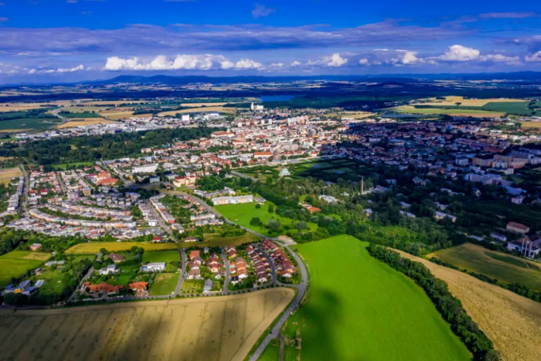


Kroměříž above its green outskirts
The aerial photographs of Kroměříž lead from large green areas to the more densely built-up districts. The flat horizon shows the extent of the place. Up close, however, the differences between individual building groups, streets and open areas become more significant.
The city and its green anteroom
In Kroměříž, green areas break up the dense buildings. Together with the open landscape in the background, they give a view of the outskirts several distinguishable levels.
The gaps between the houses reveal how tightly built the place is. An inner courtyard opens up the roof structure, a treetop covers part of it, and a wide street separates two blocks. Anyone who looks at the photo can follow these gaps and get a clearer picture than if they tried to identify each building individually. A particularly suitable view for a city portrait is one in which the view from a clearly visible roof can move on to the neighboring streets.
The open spaces between the buildings
In a green area, the view from above shows, in addition to the trees, primarily the open spaces. A path can change direction in an open area, and dense vegetation can almost completely obscure a building. The system is easier to understand when they interact together than through individual trees or roofs. If you want to explain a park area in a picture, look for a place where the path, open space and vegetation come together. It offers an easy-to-read introduction to the larger floor plan.
The distance in the composition of the image
The position of the horizon determines how much space the landscape receives. If it is high in the image, more details can be seen on the ground. A lower horizon gives greater weight to the sky and weather. Both options can accurately describe a place if the connection to the main motif remains recognizable. When comparing two aerial photos, it is worth taking a look at the foreground. Often it is an inconspicuous piece of land at the bottom edge of the picture that conveys a sense of the vastness.
The distribution of blue tones
For a direct image comparison, use shot 5 and shot 2 from the gallery with 7 aerial photos. In the first excerpt, shades of blue play a smaller role. In the second shot, blue areas take up more space. Blue can extend over a large contiguous area or only appear in individual parts. What also counts for the effect is whether these areas extend to the edge of the picture or surround the main subject.
According to camera data, Shot 1 and Shot 7 were taken on July 7, 2020. There is a gap of around 7 minutes between the two pictures. The exposure time was 1/800 second for the first of the images mentioned and 1/1000 second for the second.
A moving view is also available. Under Aerial videos you can find the clip “The village of Kromeriz in the Czech Republic from the air”. The linked preview leads to inclusion in the aerial photographer's portfolio on Adobe Stock.
Prepare a cityscape for readers
A local person will often recognize a street by a single roof. Anyone who sees the city for the first time needs more clues. For a city guide, a short caption can best start at a visible intersection and lead the eye from there to the actual subject. The aerial photographer sees the surroundings outside the section while taking the picture. Readers will later only see the published area. Especially when cropping later, it is worth checking whether the connection described can still be seen in the final image.
Related motifs in the aerial photo archive
The article Ganderkesee offers another perspective. Over Ganderkesee the view extends far beyond the town center. In the gallery Italy – Pisa there is a different focus. The aerial photos of Pisa provide a view of a largely flat urban landscape.